Flash Floods: Southwest Rivers Break Records, Forcing Evacuations
Officials in Arizona and Colorado ordered immediate evacuations as storm systems delivered months of rain in days, sending the San Juan River toward historic highs.
By Maya Morris ·
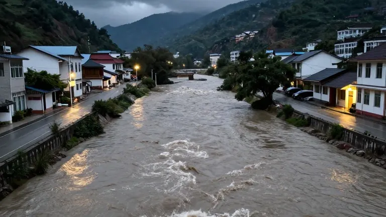
Storm systems have dumped heavy rainfall across the arid Southwest, triggering flash floods and mandatory evacuations in Arizona and Colorado. The weather pattern has overwhelmed local infrastructure, forcing residents to leave their homes as rivers swell to dangerous levels. Authorities in both states issued alerts on Sunday, warning that the current conditions are testing the limits of emergency response capabilities in regions not accustomed to such intense precipitation.
In Pagosa Springs, Colorado, the San Juan River is forecast to crest at more than 19 feet around 11:00 p.m. Sunday. This prediction exceeds the water level recorded during the 1911 flood, which wiped out most of the town and reached approximately 17.8 feet. The Archuleta County Sheriff’s Office described the event as potentially catastrophic, noting that extensive damage is expected. Town officials advised residents in low-lying areas along the San Juan, Rio Blanco, Navajo, and Piedra Rivers to move to a designated shelter at a local church immediately.
Officials in Pagosa Springs emphasized that residents should not wait for instructions, as emergency crews may be stretched thin during the peak of the storm. The highway entering the town was scheduled to close to inbound traffic on Sunday afternoon. The urgency reflects the rapid rise of the river, which threatens a community known for its hot springs and ski resorts.
Similar emergency measures took hold in Sedona, Arizona. Authorities ordered residents near Oak Creek to evacuate immediately as floodwaters rose rapidly. Multiple people were reported trapped in their homes. Nearby Camp Verde also issued evacuation orders for residents living along the Verde River, West Clear Creek, and Wet Beaver Creek. The Sedona Fire District directed affected residents to head to Sedona Red Rock High School for shelter.
Ed Mezulis, the Sedona Fire District Chief, stated that local fire and police officials were responding to multiple reports of trapped residents. He noted that emergency crews from surrounding communities were arriving to assist. Mezulis advised the public to stay on high ground, monitor alerts, and exercise caution. A video shared by the fire department showed powerful brown waters inundating vehicles and rushing past homes.
Aaron Hardin, a meteorologist with the National Weather Service in Tucson, explained the intensity of the event. He noted that the region is receiving two or three months of rain in a span of a couple of days. This rapid accumulation has resulted in flash floods, possible river flooding, and swift boat rescues in Tucson, located 230 miles south of Sedona. The weather service estimates that as much as 4 inches of rain could fall across the region, fueled by a series of Pacific storm systems.
The National Weather Service issued flood watches for nearly all of Arizona, as well as parts of southern Utah, southwestern Colorado, western New Mexico, and southern Nevada. This area includes the Four Corners region where four states meet. The rains started Saturday evening and are expected to continue through Monday, impacting already saturated ground.
In Sedona, officials urged residents not to drive across roads with rushing waters and to stay away from creek beds and washes. Social media posts included images of people standing on a pedestrian bridge, filming the churning water below. The combination of rapid water rise and limited emergency access has created a volatile situation for working families and residents in these normally dry communities.
The current weather event follows a period of heavy rain, leaving residents weary from repeated flooding. The forecast indicates that the saturated conditions will persist through the weekend, maintaining high risks for additional flash flooding. Authorities in both states continue to monitor river levels and coordinate shelter operations as the storm systems move through the region.
Source: WTOP News